|
|
|
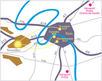
Venue > Access information and mapsMap of Versailles showing the venue of the conference ____________________________________________ The following detailled map includes the different locations of the conference (in red), some hotels (in blue) in Versailles and Saint-Cyr (west side of Versailles, accessible by bus P, or RER C train line), and the train stations (in green). See detailed information below.____________________________________________ How to get to Versailles from CDG Paris airport ?The Roissy Charles-de-Gaulle airport (CDG) of Paris is lcoated at 43 km from Versailles. Coming by taxi From Charles de Gaulle airport : travel time, from 40 to 120 minutes depending on traffic ; average fare : from 70 to 110 € Coming by public transportation From Charles de Gaulle airport : travel time 1h20, approx. fare : 15.70 €. See our suggested route here or here. To find other routes, you can also consult the transportation network in Paris area on this Paris area transportation interactive map. How to get around Versailles city ?The nearest train station from the Versailles University campus is Montreuil (SNCF, Transilien L line) in Versailles. It is a direct line to Paris Gare Saint Lazare. Be careful not to confuse with Montreuil city in the east of Paris area ! Note that Versailles city is accessible by 3 different train lines from Paris (see map below, detailed information, and 'plan a journey' RATP page):
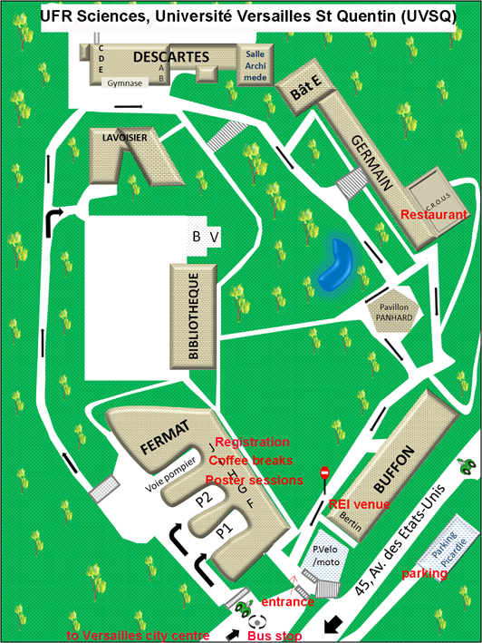
A bus network is available in Versailles and surroundings (see Phebus bus map and prices - buying a set of 10 Tickets t+ at train stations saves 20%, instead of buying it in the bus). How to come to the University campus ?The campus is accessible by foot from Versailles city centre (20-30 minutes walk), and from Montreuil SNCF train station (10 minutes walk). The campus is also accessible by Phebus bus line R (unavailable on Sundays) from the two train stations Montreuil (Transilien L line), and Versailles-Chantiers (RER C line station, approx. 15 minutes bus trip). The University campus is also accessible by Phebus lines E, F, and O (see detailed West map and East map). Only the Phebus line F is available on Sundays, one bus per hour (see timetables). The campus is also accessible by car, see details. How to find your way on the University campus ?The conference will take place in the Bertin amphitheater (Buffon building). Coffee breaks, poster sessions, and school will take place in the Fermat building (Amphi I). Lunches will be served in the Germain building (CROUS). See map below.
____________________________________________ |
| Online user: 1 | RSS Feed |

|


